RTK
Corrects the drone's position during the flight, so fewer ground control points are needed.

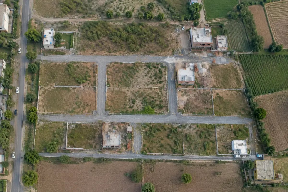
Land and property survey
A drone land survey maps a plot, a farm or a whole property from the air in one visit: a measured photo map, the area, levels and contours, and an elevation model you can plan on. NVX flies land and property surveys across India from New Delhi, with RTK positioning and ground control points where the accuracy needs them.
Standard outputs from a land or property survey. You choose the ones you need when you ask for a quote.
| Output | What it shows | Typical use | Format |
|---|---|---|---|
| Orthomosaic map | A geo-referenced, high-resolution aerial photo map you can measure on | Plot layout, area and what is built on the land | GeoTIFF |
| Area and boundary map | Measured area and the visible edges of the plot: walls, fences, roads and field bunds | Planning, sale and purchase checks, comparing with records | CAD or GIS file |
| Contours | Lines of equal ground level at the interval you need | Site design, levelling and drainage | DXF or SHP |
| Elevation models (DSM / DTM) | Surface heights, and bare-ground heights | Earthwork, drainage and flood planning | GIS raster |
| 3D model and point cloud | The shape of the site and its buildings in 3D | Visualisation, measurement and planning | LAS or OBJ |
| Report | A plain-language summary with the accuracy achieved and the methods used | Records and sharing with your engineer or architect |
A drone survey is faster and captures far more detail on most open land, but some jobs still need a ground survey. We say so honestly.
| Your need | Drone survey | Ground survey |
|---|---|---|
| A farm, layout or large plot | Best fit: the whole area in one visit | Slow on large areas |
| Levels and contours for design | Good fit: dense heights across the whole site | Heights only where the crew measures |
| Legal boundary demarcation or pillar stake-out | Not a substitute | Needed, with official land records |
| Land under dense trees | Photos see only the canopy; LiDAR may help | Often the better choice |
| A small plot between tall buildings | Possible, depending on airspace and access | Often simpler |
A drone survey shows what is on the ground: walls, fences, roads, buildings and levels. Legal boundaries, ownership and demarcation come from your state's land revenue records and official surveyors. A drone map is useful to plan, to measure, to spot encroachment and to compare with records, but it does not replace an official demarcation or a title document.
Saksham, the Indian made drone NVX flies for mapping, supports RTK positioning. For survey-grade work we add ground control points measured with survey GNSS, and check points to confirm the result. The accuracy actually achieved is stated in the report for your site.
Corrects the drone's position during the flight, so fewer ground control points are needed.
Marked points measured on the ground that tie the map to real coordinates.
Extra measured points, not used in processing, that show how accurate the map is.
From your location pin to a measured map.
The more of this you share, the faster and more exact the quote.
A Google Maps pin, coordinates or a KML/KMZ file.
A sketch, a layout plan or the corner points, if you have them.
Approximate size in acres, hectares or square metres.
Map, area, contours, elevation model, 3D model, and the file formats.
When you need the results, and how the team reaches the site.
Land surveys are quoted per site. These are the main reasons quotes differ; our drone survey cost guide explains each one.
Larger areas cost more in total but less per acre; long, thin sites need more flight lines.
Slopes, trees and buildings change the flight plan and processing.
RTK and ground control points add field time but give survey-grade results.
A map alone costs less than a map with contours, elevation models and a 3D model.
Travel outside Delhi NCR is quoted with the project.
Sites in yellow or red zones need permission first, which adds time.
FAQ
Yes. Drones map land, plots, farms and property quickly: a measured photo map, the area, contours and elevation models. With RTK and ground control points the results are accurate enough for engineering and planning. A drone map does not replace legal boundary demarcation, which comes from land records and official surveyors.
Flying a few hundred acres usually takes a day or less; processing and reporting take a few more days depending on the outputs. NVX confirms the schedule for your site in the quote.
Yes. NVX is based in New Delhi and surveys land across India. Travel outside Delhi NCR is quoted with the project.
It depends on area, terrain, accuracy and outputs. Rates commonly quoted in India for standard RGB mapping are roughly ₹500 to ₹1,500 per acre, falling for larger areas. NVX sends a written quote after seeing the site and your requirements.
No. It shows what is on the ground and is useful for planning, measuring and comparing with records, but legal boundaries and demarcation come from your state's land revenue records and official surveyors.
Saksham, NVX's Indian made enterprise drone with RTK and 55+ minutes of flight. For land under tree cover or tight spaces, LiDAR mapping is available as a service.
The drone needs a UIN on Digital Sky and the pilot a Remote Pilot Certificate. Green zones need no flight permission; yellow and red zones need permission first. NVX checks the zone and plans the flight.
Get a quote
NVX replies with a recommended configuration and quotation.
Related